Alice Richardson
This project was an exploration of contemporary collage urbanism, using fragments of history and narratives to repair missing portions of Dover’s Western Docks. This is framed in an urban strategy for a revived Pier District, at the heart of which, a new public realm is proposed.
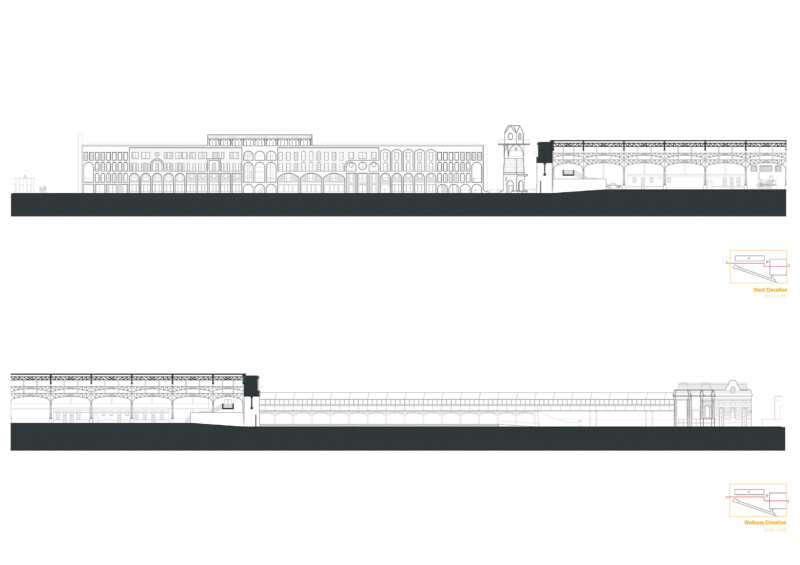
The site extends across the Western Docks in Dover, South East England, with a focus towards the Former Marine Station.
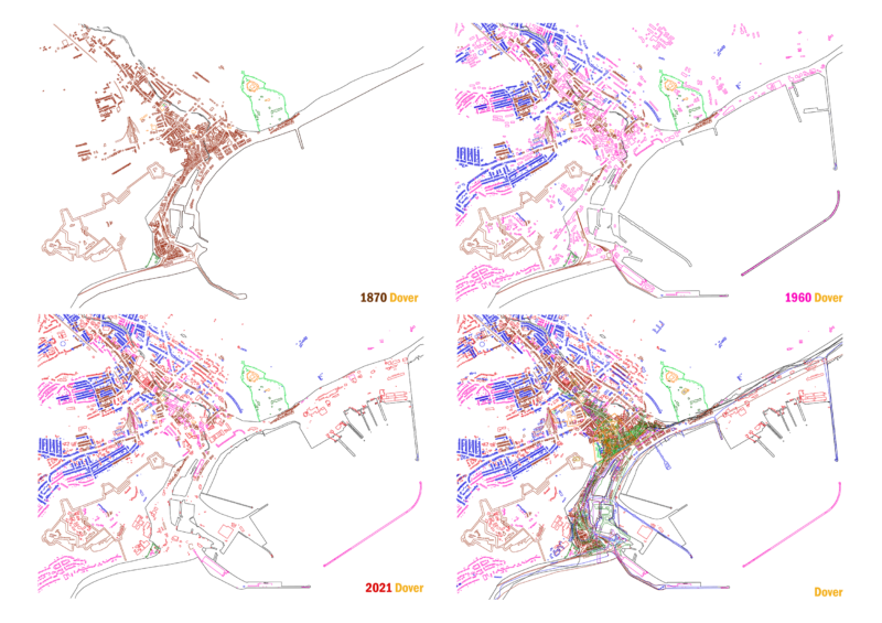
An interest in the echoes of historic architecture was prompted through the historical mapping of Dover. Unearthed was the existence of a once vibrant Pier District in the Western Docks, and the changes this portion of the town had experienced. When all the maps are overlaid, a historical density is latent within the site, comparable to that of Dover’s current town centre, and yet is found predominantly baron, but for parking.
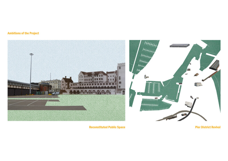
The ambitions of the project were primarily set up in an initial collage, where the focus was impulsively directed towards the spaces around the Former Marine Station, rather than within it. A reverse engineering took place, reconstructing the collage as physical spaces, in which I considered what these components may be.
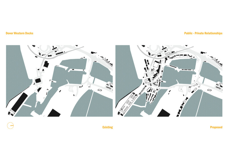
From this, the extent of the docklands was explored. I propose to repopulate and connect the vast space, with Dover and beyond, with public-private relationships informing these routes. The logistical strategy for this consists of a swap in programmes. Re-locating the truck park in the docklands to the periphery of Dover, to an existing truck park, expanding capacity for this by re-locating the adjacent Dover Transport Museum to the Former Marine Station. Additionally, the Former Harbour Station in the docklands is to be reinstated, with a procession of spaces generating a route between this and the Former Marine Station.
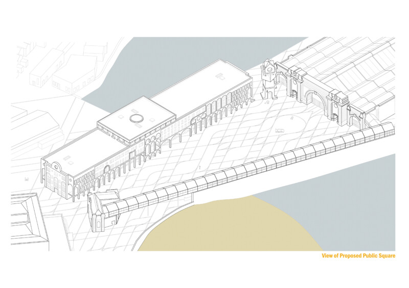
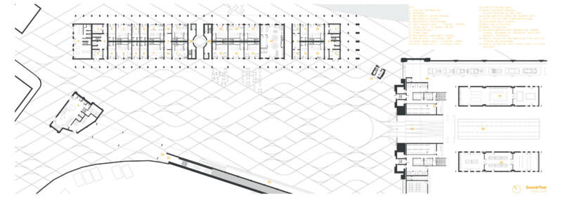
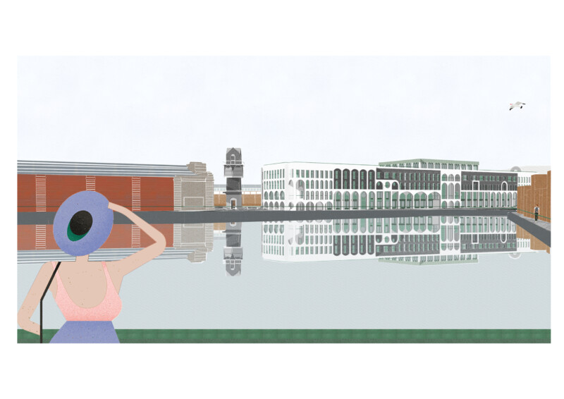
The main public space proposed consists of three new components: a mixed-use building, a viewing tower, and a paving design.
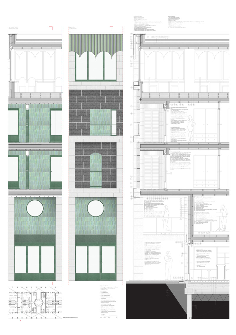
To develop these, visual archives were collated using virtual public sources of local history, forming repositories of both the lost district and buildings of Dover. These archives were reproduced in a range of mediums, imposing a layer between the original and myself, pulling out what was important in this process. Collective memory, collage-thinking and public space were further explored in a concurrent research paper, with multiple narratives highlighted as a principle for both the repair and endurance of urban realms. Through a process of collage, layering, and re-working, a multiplicity of reference was submerged in the facades and surfaces, that form the backdrops to the public spaces I generated in this project.
The role of the façade; orchestrating external space whilst working with the programmes contained behind them, was questioned in the project. The new building subsequently came to be formed of two skins, each working independently with their immediate spaces, whilst in conversation with each other. Meanwhile, the viewing tower became an explicit assemblage of collaged fragments, and the paving, an evocation of prior use, framed in a new context.
Contact Alice Richardson
- alicehrichardson@icloud.com